 |
Sunrise/Sunset Charts: notes |
|
Twilight is not measured in light intensity, it is determined by the sun's position relative to the horizon. There are three types of twilight (Civil, Nautical and Astronomical): the Twilight shown in the chart is Civil Twilight, which is defined as the time when the Sun is 6° below the horizon. | |
|
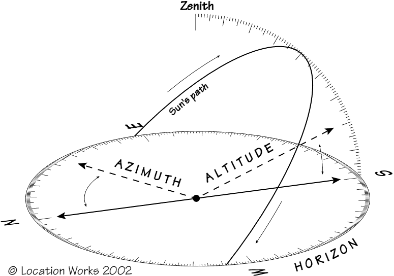
The Azimuth of sunrise/sunset is the compass bearing. North is 0°, East is 90°, etc. On the equinox (approx March 21st/September 21st), the sun rises due east and sets due west (all over the world). At other times, the sun rises north or south of due east. The Altitude of the sun is measured from 0° on the horizon, to 90° at the zenith (the point of the sky directly above you). In the UK, in summer months, the sun will be seen to rise in the north-east, and as it travels clockwise it climbs higher in the sky until it reaches its highest point, at which point it is due south of the observer. From there it descends until it sets north-west. |
|
|
The Times and Azimuths shown assume a flat (nautical) horizon. The Solar Location Diagram can be used to determine the times/azimuths of sunrise & sunset in situations where the horizon is obscured. Determine the altitude of the obstruction, e.g. building or mountain, then use the solar location diagram to determine the time & azimuth of sunrise/sunset. | |
|
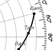
Example: let's say there is a mountain which has an altitude of 10° relative to the horizon. The concentric lines on the Solar Location Diagram represent 10° of altitude, with the outermost representing the horizon. In the example diagram shown left, the second concentric line - representing 10° - meets the sun's path when the sun is due East, at about 07:10. |
|
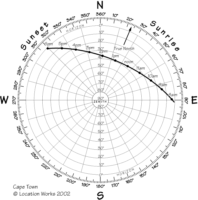
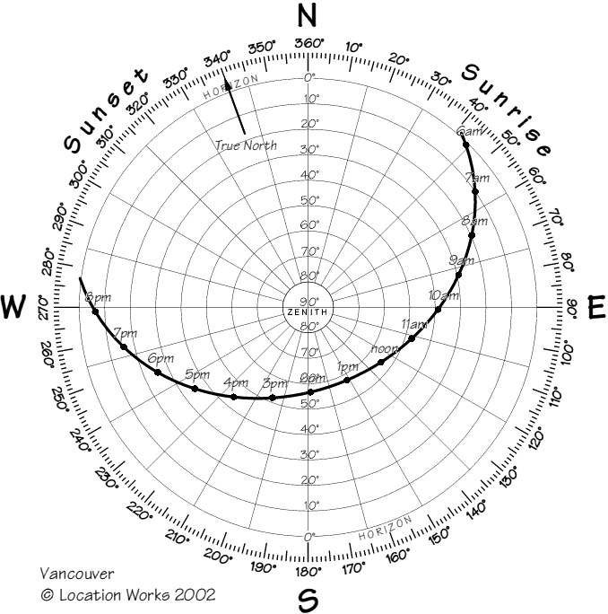
Many countries use Daylight Saving Hours in summer, where the clock is moved forward/back one hour. If these hours apply, times will be shown on the chart followed by an asterisk. Magnetic Declination is the term used to describe the difference between True North and Magnetic North. The Calculations shown in the Sunrise/Sunset Predictions have made an allowance for this difference, therefore the azimuths and altitudes shown are accurate to the readings shown on your magnetic compass. For an explanation, see: Geological Survey of Canada: Magnetic Declination and to find the declination for your area, see: GSC Canadian Geomagnetic Reference Field (you will need to know your latitude and longitude). If Magnetic Declination applies, this will result in an asymmetric path in the Solar Location Diagram: compare the diagrams below for the same day (August 1st) in Cape Town and Vancouver. | |
 | |